Ecuador's Quilotoa Loop in Late March Offers Crater Lake Views and Empty Andean Guesthouses Before Easter Holiday Crowds Arrive
Marcus Chen
09/19/2026
6 min read
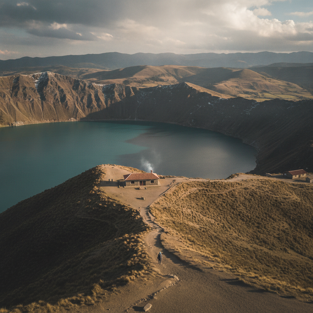
Some of the most rewarding travel experiences in South America happen not at peak season but in the quiet weeks just before the calendar turns busy. Ecuador's Quilotoa Loop — a highland trekking circuit in the central Andes that winds through indigenous villages, cloud-swept páramo, and dramatic volcanic terrain — sits firmly in that category. By late March, the rains of the wet season have begun to ease, the landscape holds a vivid green that photographs can barely do justice, and the crater lake at the heart of the route glows in shades of turquoise and jade that shift visibly throughout the day. Most importantly, the guesthouses along the trail are quiet, the villagers are unhurried, and the paths feel genuinely yours.
What Makes the Quilotoa Loop Different From Ecuador's Other Highland Routes?
The Quilotoa Loop doesn't follow a single trail so much as it strings together a loose chain of small Andean communities — Sigchos, Isinliví, Chugchilán, and Quilotoa itself — across terrain that rises and falls dramatically between river gorges and open ridgelines. What distinguishes it from more famous Andean circuits in Peru or Bolivia is its human scale. The distances between villages are manageable on foot in a day, the altitude stays mostly between 2,800 and 3,900 meters, and the route passes through active farming communities where daily life continues with or without visitors. Locals raise sheep and llamas on the hillsides, weave textiles in doorways, and tend market stalls that have operated the same way for generations. For travelers who want proximity to authentic Andean culture without the infrastructure overhead of a major tourist hub, the loop delivers something rare.
The crater lake at Quilotoa formed inside a collapsed volcano roughly 800 years ago and sits at about 3,900 meters. Its color — that particular blue-green that appears in almost every photograph of the region — comes from dissolved minerals and shifts from turquoise at midday to a deep teal in the late afternoon. In late March, the morning mist that rises off the water before the sun clears the crater rim adds a layer of atmosphere that the drier, busier months simply don't offer. The trail down to the lake's edge takes roughly 30 to 45 minutes from the rim, and the climb back up is the kind of cardiovascular work that reminds visitors they're at altitude. Reaching the bottom before 9 a.m., before the day hikers begin arriving from Latacunga, means having the shoreline almost entirely to oneself.
When Should You Plan the Timing and What to Expect on the Ground?
Late March represents a genuine sweet spot for the Quilotoa Loop. Easter week — Semana Santa — typically falls in April, and Ecuadorians treat it as one of the year's major holiday periods. Families travel, guesthouses fill, and the usually quiet trail towns can feel unexpectedly crowded for those accustomed to shoulder-season calm. Arriving in the final weeks of March means beating that wave while still benefiting from improving weather. The heavy afternoon rains of January and February have largely passed, mornings tend to be clear, and the vegetation along the route is at its most lush.
Accommodation on the loop is simple but comfortable — think family-run hostels with wood stoves, thick blankets, and dinners that might include lentil soup, rice, and freshly baked bread. The Black Sheep Inn outside Chugchilán is perhaps the most well-known option along the route, a long-running eco-lodge that has become something of an institution for Quilotoa trekkers. Reservations there fill months ahead for Semana Santa but are typically available with a week or two of notice in late March. Smaller family guesthouses in Isinliví and Sigchos tend to remain available with even less lead time. Booking through WhatsApp is genuinely common and effective — many hosts respond faster through that channel than through any formal platform.
For logistics and navigation, the app Maps.me carries offline maps that include the loop's trail segments with enough detail to follow the route between villages without a guide. Google Maps covers the road sections but misses many of the footpaths that make the loop most interesting. The Wikiloc app hosts dozens of GPS tracks uploaded by previous trekkers, and filtering for recent uploads helps identify which trail sections are in good condition after the wet season. The route is generally manageable without a guide for experienced hikers, though hiring a local guide from one of the village guesthouses is inexpensive and puts money directly into the communities the trail passes through.
How Do You Build a Four-Day Itinerary That Captures the Best of the Loop?
Most independent trekkers approach the loop over three to five days, starting from the town of Latacunga — easily reached by bus from Quito in about two hours — and ending at the Quilotoa crater, or vice versa. A four-day approach allows for unhurried walking, with overnight stops in Sigchos, Isinliví, and Chugchilán before reaching the lake on the final morning.
Day one from Latacunga to Sigchos involves a bus and then a moderate walk into the Toachi River canyon. Day two covers the descent into the gorge and the long climb out toward Isinliví, where the guesthouse at Llullu Llama has built a quiet reputation for good food and warm hospitality. Day three from Isinliví to Chugchilán passes through open farmland with sweeping views back toward Cotopaxi on clear mornings. The final day's walk to the Quilotoa crater rim saves the most dramatic scenery for last, arriving in time to watch the afternoon light change the lake's color before catching a bus back to Latacunga. Buying bus tickets at the Latacunga terminal for the return — rather than through a third-party app — tends to be straightforward and cash-based, so carrying enough sucres for the journey matters.
For those who prefer a lighter pack, agencies in Quito and Latacunga offer luggage transfer services between guesthouses, a practical option that allows for day hiking without carrying everything. GetYourGuide lists several supported loop itineraries for travelers who want a hybrid of independence and logistical support, though the truly budget-conscious will find the DIY approach adds up to very little in total cost across four days.
The Quilotoa Loop rewards preparation more than spontaneity, but the preparation involved is genuinely modest — a reliable offline map, a confirmed first-night bed, and an understanding that late March weather can shift from sunny to cold rain within an hour. Layers matter more than technical gear, and the guesthouses along the route provide enough warmth and comfort that the experience never tips into hardship. For anyone drawn to Andean landscapes, indigenous culture, and the particular satisfaction of arriving somewhere beautiful before the crowds do, the window between now and Semana Santa is worth taking seriously. Start with one night's reservation in Isinliví or Chugchilán, pull up the loop on Maps.me, and let the rest arrange itself from there.
More Trending Articles

How Reading Blender Motor Wattage Against Blade Design Specifications Reveals Which Mid-Range Models Match Premium Performance at Half the Cost
Jennifer Walsh
09/20/2026